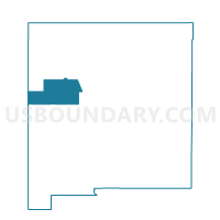
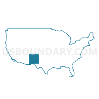
Census Tract 9747, Cibola County, New Mexico
About
** Data sources from census 2010 **
Maps
Graphs
Neighbors
Neighoring Census Tract (by Name) Neighboring Census Tract on the Map
- Census Tract 109, Sandoval County, NM
- Census Tract 9400, Socorro County, NM
- Census Tract 9405, McKinley County, NM
- Census Tract 9406, Bernalillo County, NM
- Census Tract 9415, Cibola County, NM
- Census Tract 9440, McKinley County, NM
- Census Tract 9451, Apache County, AZ
- Census Tract 9458, Cibola County, NM
- Census Tract 9460, McKinley County, NM
- Census Tract 9461, Cibola County, NM
- Census Tract 9702, Apache County, AZ
- Census Tract 9731, McKinley County, NM
- Census Tract 9742.01, Cibola County, NM
- Census Tract 9742.02, Cibola County, NM
- Census Tract 9744, Cibola County, NM
- Census Tract 9764, Catron County, NM
Top 10 Neighboring County Subdivision (by Population) Neighboring County Subdivision on the Map
- Red Rock CCD, McKinley County, NM (24,280)
- Grants CCD, Cibola County, NM (20,500)
- St. Johns CCD, Apache County, AZ (8,235)
- Zuni CCD, McKinley County, NM (7,881)
- West Bernalillo CCD, Bernalillo County, NM (7,796)
- Crownpoint CCD, McKinley County, NM (5,609)
- Cuba CCD, Sandoval County, NM (4,986)
- Laguna CCD, Cibola County, NM (4,459)
- Magdalena CCD, Socorro County, NM (3,415)
- Puerco CCD, Apache County, AZ (2,499)
Top 10 Neighboring Place (by Population) Neighboring Place on the Map
- Grants city, NM (9,182)
- Milan village, NM (3,245)
- San Rafael CDP, NM (933)
- Bluewater Village CDP, NM (628)
- Seama CDP, NM (465)
- Paguate CDP, NM (421)
- Acomita Lake CDP, NM (416)
- Ramah CDP, NM (370)
- North Acomita Village CDP, NM (303)
- Cubero CDP, NM (289)
Top 10 Neighboring Unified School District (by Population) Neighboring Unified School District on the Map
- Albuquerque Public Schools, NM (667,445)
- Gallup-Mckinley County Schools, NM (63,611)
- Grants-Cibola County Schools, NM (27,088)
- Zuni Public Schools, NM (7,881)
- Sanders Unified District, AZ (5,899)
- Cuba Independent Schools, NM (4,584)
- St. Johns Unified District, AZ (4,198)
- Magdalena Municipal Schools, NM (2,984)
- Quemado Independent Schools, NM (1,779)
Top 10 Neighboring State Legislative District Lower Chamber (by Population) Neighboring State Legislative District Lower Chamber on the Map
- State House District 5, AZ (192,258)
- State House District 2, AZ (177,904)
- State House District 12, NM (38,723)
- State House District 49, NM (31,024)
- State House District 6, NM (27,357)
- State House District 69, NM (26,984)
- State House District 65, NM (26,930)
Top 10 Neighboring State Legislative District Upper Chamber (by Population) Neighboring State Legislative District Upper Chamber on the Map
- State Senate District 5, AZ (192,258)
- State Senate District 2, AZ (177,904)
- State Senate District 22, NM (60,988)
- State Senate District 30, NM (48,188)
- State Senate District 4, NM (43,917)
- State Senate District 28, NM (43,562)
Top 10 Neighboring 111th Congressional District (by Population) Neighboring 111th Congressional District on the Map
- Congressional District 1, AZ (774,310)
- Congressional District 3, NM (693,284)
- Congressional District 2, NM (663,956)
Top 10 Neighboring 5-Digit ZIP Code Tabulation Area (by Population) Neighboring 5-Digit ZIP Code Tabulation Area on the Map
- 87020, NM (11,347)
- 87327, NM (7,883)
- 87013, NM (5,200)
- 87323, NM (4,558)
- 85936, AZ (4,293)
- 87026, NM (4,063)
- 87021, NM (3,472)
- 86512, AZ (2,439)
- 87321, NM (2,226)
- 87034, NM (2,207)


